This post is long in coming. My wife, Oops, and I backpacked in this lovely wilderness area last month, when it was still pretty warm, and there were still forest fires raging in the Mt. Jefferson area nearby. If you are wondering where the Bull of the Woods is, you aren’t alone. It’s probably one of the least known wild areas in the state, and yet it’s just a hop, skip and a drive down to Salem and over to Detroit Lake.
Actually there are a few ways to get in there. One is from the north. Travel southeast on Hwy 224 past Estacada, turn south on USFS 54, drive a few miles and then turn on 70 toward Bagby Hot Springs. You can park at the trailhead to the hot springs and walk south for 7 miles and you’ll be in the wilderness.
Or you can come in from the south like we did. From Detroit it’s just a short drive up USFS 46 before you turn off on 4697, which is a 7 mile long gravel road ending at Elk Lake. Elk Lake is a quite popular camping and fishing spot. It’s also the origin of many trails into this pristine wilderness area.
Bull of the Woods was designated in 1984, not that long ago. It is over 27,000 acres in size, and like it’s more recent neighbor, Opal Creek, it is filled with large trees and steep slopes. I found it quite funny that, after recalling all the fuss over the Opal Creek area as being one of the last vestiges of old growth in the state, there was an area more than twice the size right next door that loggers haven’t touched in a century (if they ever did).
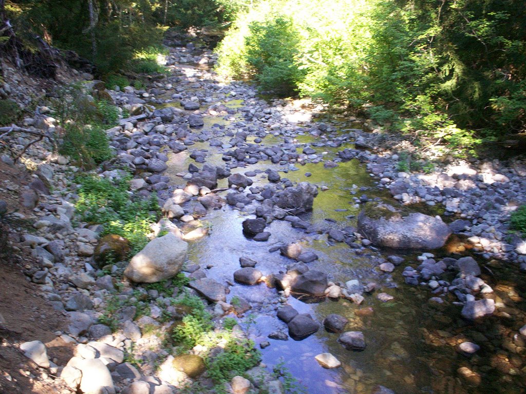
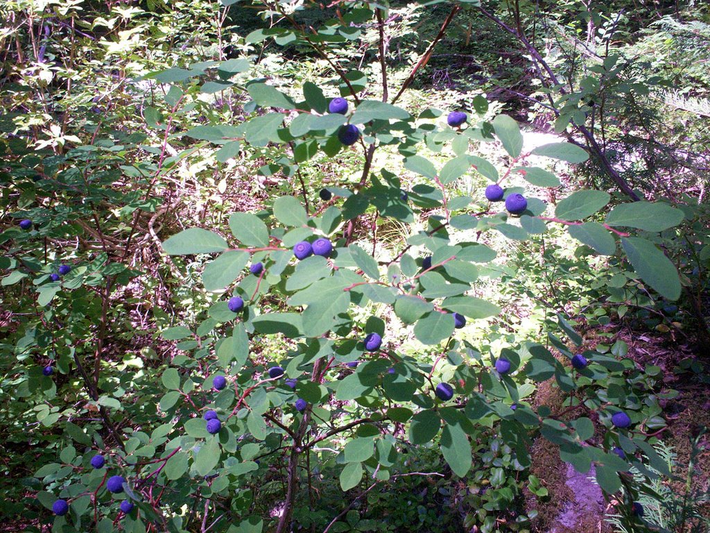 We set off on a 25 mile loop of the area, designed to take in most of the sights. We started down trail 559 and traveled 7 miles along Elk Lake Creek. This is an easy going trail, with not that much elevation change. The beginning is soft tread and large trees. We were surrounded by mountain blueberry and red huckleberries for much of the hike.
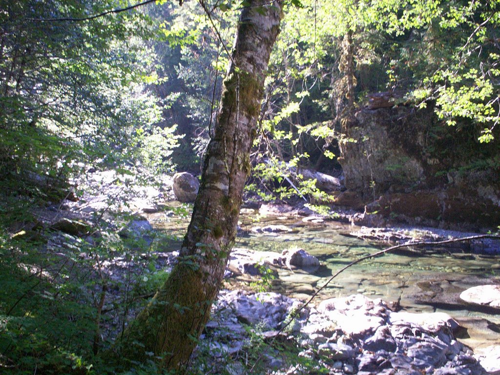 The lower end of the creek had quite a few places where jumping in was tempting. It looked cool and clear and it was pretty hot that day, but we wanted to get closer to the ridge-top before it got dark, so up we went on trail 554 to the Welcome Lakes. It’s a 2000 foot climb in 3 miles to the top, which is a pretty good climb, but we made it. We didn’t like the camp situation at the lakes, and Oops wanted a sunset view so we kept going up to the ridge to see if there was anything up there. I got kind of nervous, as the ridge is pretty sharp and steep, not many flat spots for camping, but after a mile, just past the trail junction for 556, there was a great spot that had views of the Bull of the Woods peak and the sunset. In the morning we had the sunrise too.
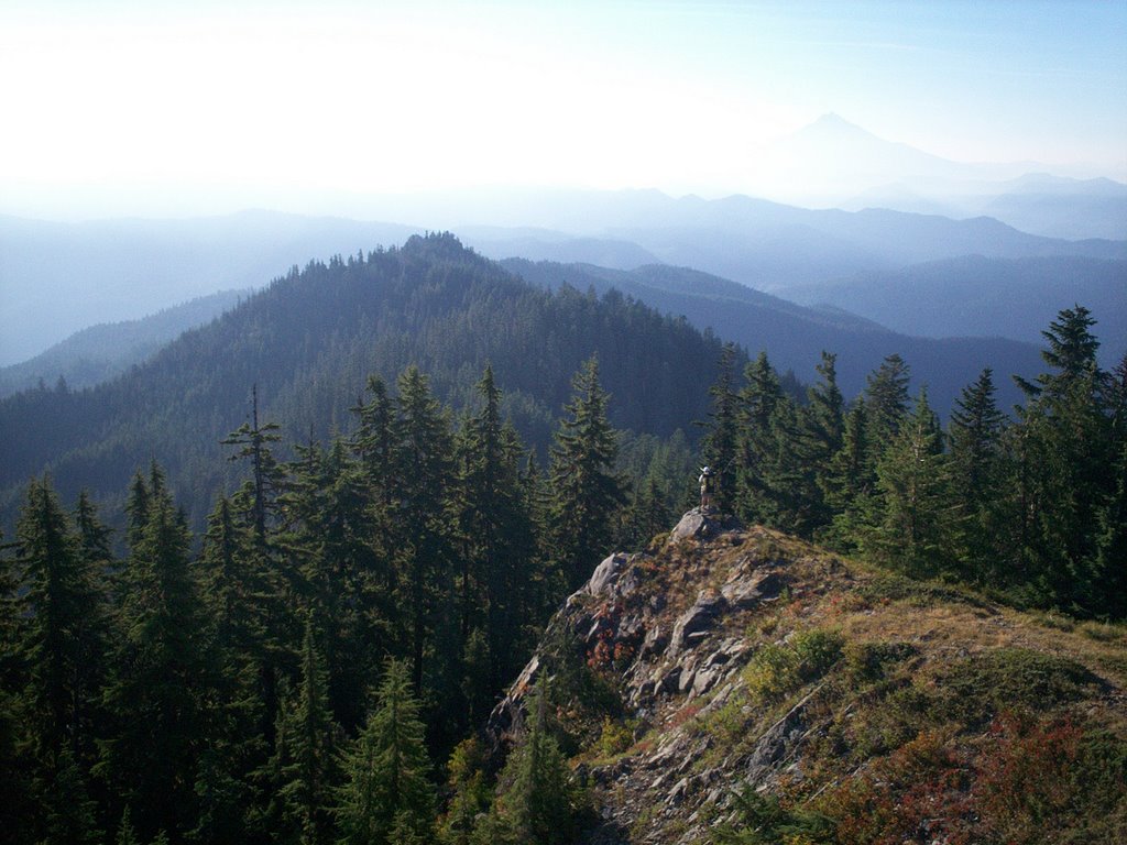
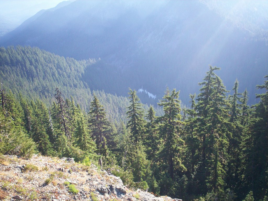
 During the night we heard lots of wildlife, such as bats flying over our tent, and elk tromping around and bugling in the middle of the night. By morning, though, we were on our own. We took the side trail up to Bull of the Woods peak, where there is a lookout tower, and got a 360 degree view of the Cascades. Wow! Due to the fires, we couldn’t see quite as far as one normally can, but we could see Mt. Jefferson and Mt. Hood as silhouettes in the smoke. All the surrounding mountains and ridges were very visible and the view was awesome.
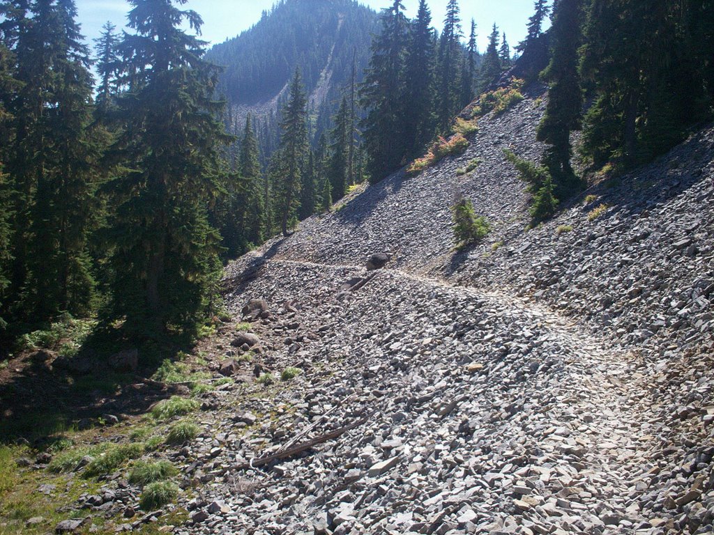
 An eight mile hike got us into the Mother Lode basin (which was pretty dry at this late date), up onto the side of Mother Lode peak (which had some pretty tall trees), and down to the Twin Lakes.
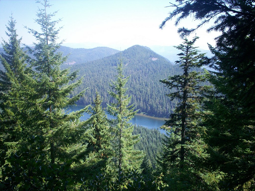
The Twin lakes have lots of sites next to them, and looked very refreshing after a couple of days on the trail. And so I took a dip. If there were any part of the area we would visit again, this would probably be it. Although I think that’s what everyone else thought too, as the trail from there back to Elk Lake was packed. You can take another side trail up to the Battle Ax peak from the ridge back to Elk Lake, but we were too bushed, so we just dropped back to the lake and drove home for some great burgers and beers at the Roadhouse.
 If you want to know what trail conditions are like, you should visit the TrailAdvocate site. It’s a local site run by people who like to hike in the area and want to keep the trails in good working order, as the Forest Service doesn’t quite have the budget it seems. They’re pretty nice, and I had a good correspondence with one of the guys and got good information (although he down-played the fallen timber along the trail, as there are lots of logs to crawl over and under).
 We used Green Trails maps, which you can get at any REI or outdoor store. However, I would like to recommend David Imus’ maps. David is a master cartographer, and makes really nice recreation maps, complete with topography and mileage on the trails. The scale is a bit better than the Green Trails maps, but I think the Green Trails are nicer to have out there, because the trails are highlighted and easier to see on the paper.
However, I’m keeping the Imus map for a souvenir.


3 comments:
Awesome post. Leaving for there tomorrow as I've meant to for a while. It seems nobody really knows much about this place!
Hiked there over Labor day weekend. The veiw from atop of Battle Axe mountain was well worth the hike on a steep trail. My 9 year old complained the last mile but he said it was worth it when he got to the top.
Looks like a great wilderness survival bug out location. Thank you for sharing!
Post a Comment